 Across
South America, from Venezuela south to Patagonia, unfold the Andes,
the most extensive mountain range of the world and the second
one in height. The Andes reach their highest point at the summit
of Aconcagua, with 6,959 m above sea level, with some of its highest
peaks shared between Chile and Argentina in the northern regions. Across
South America, from Venezuela south to Patagonia, unfold the Andes,
the most extensive mountain range of the world and the second
one in height. The Andes reach their highest point at the summit
of Aconcagua, with 6,959 m above sea level, with some of its highest
peaks shared between Chile and Argentina in the northern regions.
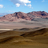
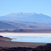
In the central zone shared by Peru, Bolivia, Chile and Argentina,
lays the high plateau known as "Altiplano" and the Argentine
Puna at an average altitude of 3,800 m. In this region,
volcanic cones extend upwards of 5,500 meters or reach altitudes
exceeding 6,000 m. On the border between Catamarca and La Rioja,
Mount Pissis, with its 6,882 m, is the highest volcano on earth.
In the last two million years, volcanic activity created enormous
closed depressions that harbor salt plains like the Salar de Antofalla,
the longest in the world with approximately 140 km of length.
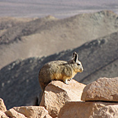
The climate in this entire area of the Andes
is extremely dry. Scarce summer rains and great daily temperarture
differentials make of the Puna a desert at high altitude without
parallel in the world. Plants and animals had to adapt to survive.
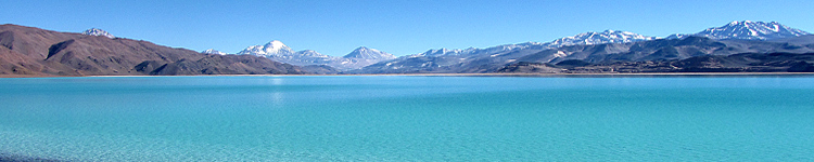
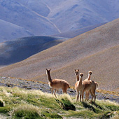
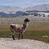
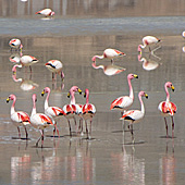
Wild vicuñas and guanacos roam the high planes, flamingoes
and other birds inhabit lagoons saturated with color at an average
altitude of 4,100 m. At an altitude of 5,530 m and a depth of
350 m, the interior lagoon of Crater Corona del Inca in La Rioja
is the highest mirror of navigable water in the world.
The Argentine northwest, also known as NOA, comprises
the provinces of Jujuy, the west and south of Salta, the north
of Catamarca and the northwest of Tucumán. It is the geographic
area that contains the Andean mountain range and includes the
mountainous elevations of the Puna, the sub-Andean mountains,
the fertile valleys, and the gorges of the Cordillera Oriental.
The most important deep mountain valleys in this region are the
Valles Calchaquíes in Salta and the Quebrada de Humahuaca
in Jujuy.
|